

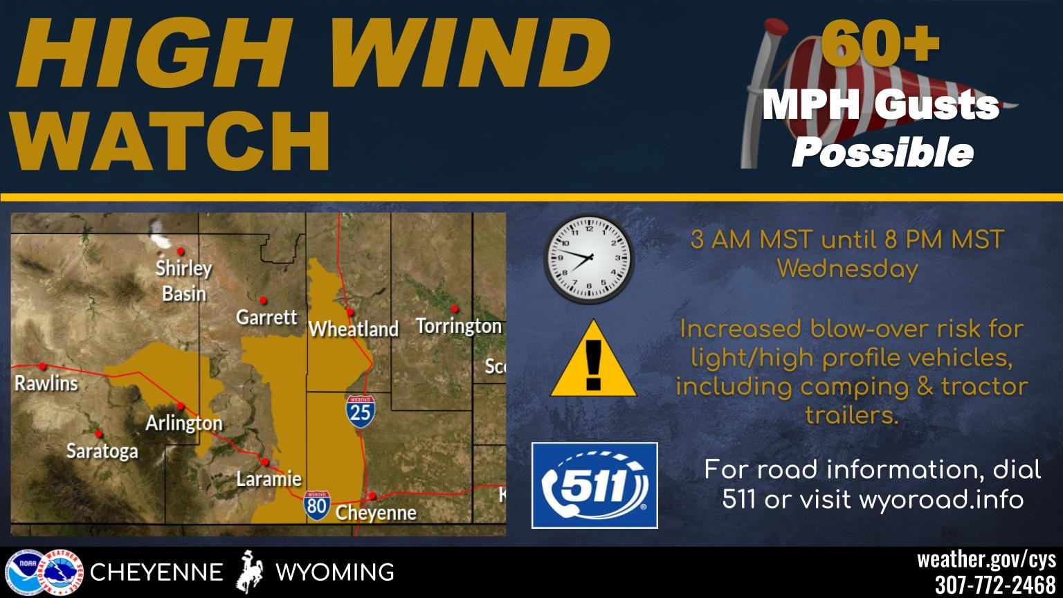
HIGH WIND WATCH IN EFFECT FROM LATE TONIGHT THROUGH WEDNESDAY
EVENING...

* WHAT...West winds 30 to 40 mph with gusts up to 65 mph
  possible.

* WHERE...North Snowy Range Foothills including Interstate 80 near
  Arlington and Elk Mountain.

* WHEN...From early Wednesday morning through Wednesday evening.

* IMPACTS...Mainly to transportation. Strong cross winds will be
  hazardous to light weight or high profile vehicles, including
  campers and tractor trailers.

PRECAUTIONARY/PREPAREDNESS ACTIONS...

Monitor the latest forecasts and warnings for updates on this
situation. Fasten loose objects or shelter objects in a safe
location prior to the onset of winds.